A new satellite-based system shows precisely where trees are being lost, with data so fast that new logging roads and illegal clearings are visible within one week after the loss, instead of months.
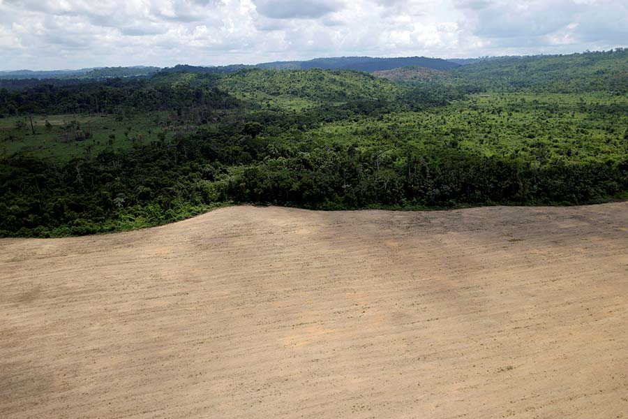
It’s a warm August day in the pristine forest of Cordillera Azul National Park, located in Central Peru’s Amazon Rainforest. Cordillera Azul, home to more than 1,800 species of plants and animals, is one of the most biologically diverse areas in the world—and one of the most endangered. On this day, new patches of forest-clearing pop up on the east side of the park’s surrounding buffer zone—some legal, some not—and for the next six months, they proliferate day after day, creeping toward the borders of the park.
We’re able to track this activity thanks to a new satellite-based forest monitoring tool, which tells us where trees are lost in as little as one week—depending on cloud coverage—after it happens. Developed by the University of Maryland and Google, the new GLAD (Global Land Analysis and Discovery) alert system now available on Global Forest Watch detects tree cover loss in Peru, Republic of Congo and Indonesian Borneo at 30-meter resolution, roughly the size of two basketball courts. Previously, governments, forest managers and communities had to wait an entire year to get detailed satellite data on tree cover loss, presenting challenges for law enforcement and anti-deforestation efforts.
Illegal logging has become a major issue in Peru, with estimates that more than 80 percent of timber in the country is illegally harvested. Selective logging is difficult to pick up directly at 30-meter resolution, but the roads used to transport the harvested timber out of the forest are large enough to be detected by the GLAD alerts. In the buffer zone around Cordillera Azul National Park, three logging roads can be seen expanding over the past six months, with a new fork popping up last month. Now that it’s rainy season in the Peruvian Amazon, the alerts seem to have stopped this month—for now. Whether that’s due to lack of visibility or cease in activity remains to be seen.
The GLAD alerts could revolutionize the way we monitor forests, beginning in Peru, Republic of Congo, and Kalimantan, and soon expanding to the rest of the world. But these alerts will not inspire action on the ground by themselves—we need people like you to use them.
With the GFW subscription, you can get an email notification every time there is a new alert in your area of interest—whether it’s in a national park, an entire country or a logging concession. The automated emails will tell you the number of new alerts in that area and a direct link to see them on the map. By keeping an eye on the world’s forests, everyone can help play a role in their protection.
Explore the data here, learn how to subscribe for alerts here, sign up for our webinar on how to use the alerts here